Vector Map of Africa

POPULATION: 1.216 Billion

SURFACE: 30.37 Million km²

NUMBER OF COUNTRIES: 54 

  • African continent is the world’s oldest populated area.
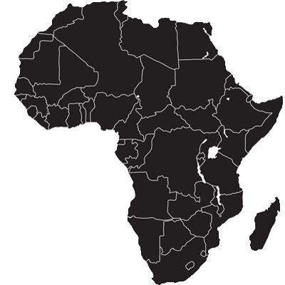
  • There are 54 countries and one “non-self governing territory”, the Western Sahara.
  • Most common language on the continent is Arabic, spoken by 170 million people, followed by English (130 million), French (115), Swahili (100), Berber (50), Hausa (50), Portuguese (20) and Spanish (10).
  • Africa is the world’s poorest and most underdeveloped continent with a continental GDP that accounts for just 2.4% of global GDP.
  • Africa is the world’s hottest continent with deserts and drylands covering 60% of land surface area.
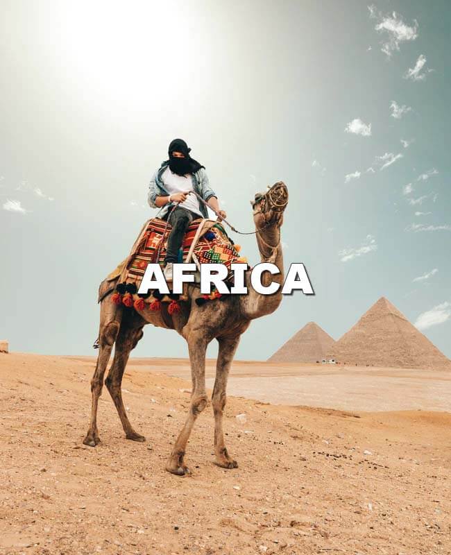
  • The Sahara is the largest desert in the world and is bigger than the continental USA.
  • Africa has approximately 30% of the earth’s remaining mineral resources.
  • The Nile River is the longest river in the world with a total length of 6,650 kilometres.
  • Lake Victoria is the largest lake in Africa and the second-largest freshwater lake in the world.
Vector Map of Asia

POPULATION: 4.46 Billion

SURFACE: 44.58 Million km²

NUMBER OF COUNTRIES: 49

  • Asia is the largest and most populated continent in the world.
  • The Asian continent covers 30% of the world’s land mass and is home to 4,46 billion people, which accounts for more than 60% of the total human population on Earth.
  • Asia is actually quite a common female name which translates to sunrise.
  • 14 of the tallest mountains in the world can be found in Asia, and they are all over 8000 meters above the sea. The highest mountain in the world is Mount Everest at 8 848.
  • Asians eat up to 90% of the total world production of rice.
  • Asia has highest number of billionaires in the world.
  • Nine out of ten of the world’s tallest buildings are in Asia.
  • It’s thought that around 2,300 different languages are spoken across the continent, with more than 600 different languages spoken just in Indonesia.
  • The most populated city in the world is the industrial city Chongqing in China with some 30 million inhabitants.
Vector Map of Australia & Oceania

POPULATION: 41.57 Million

SURFACE: 8.52 Million km²

NUMBER OF COUNTRIES: 14

  • Oceania is a region made up of thousands of islands throughout the Central and South Pacific Ocean.
  • Oceania is the smallest continent in the world in terms of land area. And its population of just over 40 million people makes it the 6th least populous continent in the world, behind Antarctica.
  • There are 14 independent countries and 12 dependent overseas territories. The largest sovereign state is Australia, occupying about 86% of the region’s total area.
  • The Polynesian people sailed most of the area in simple wooden ships centuries before Europeans. The First European to cross the area was Ferdinand Magellan, during his circumnavigation of the globe.
  • The Great Barrier Reef can be seen from space and is regarded as the world’s largest living organism, it is often listed as one of the Seven Wonders of the Natural World.
  • Australia’s dingo fence is longer than the Great Wall of China and drive from Seattle to Miami.
  • Two native Australian animals, Platypus and Echidnas, are the only two mammals in the world that lay eggs to give birth.
Vector Map of Europe

POPULATION: 746.41 Million

SURFACE: 10.18 Million km²

NUMBER OF COUNTRIES: 50

  • Europe is the second smallest continent in size but the third largest in population.
  • Europe is home to 11% of the world’s population with only 3% of the landmass.
  • The European continent houses 50 countries of which 28 nations belong to the European Union (EU).
  • More than 200 languages are being spoken throughout the continent.
  • The name Europe is believed to have derived from Greek. Europa was a princess in Greek Mythology.
  • The Vatican is the smallest country in the world and home to the Pope, while Hum in Croatia is the smallest town in the world. The town has only 21 inhabitants.
  • Italy, Spain, and France are the biggest wine producing countries in Europe, and together they account for about 70% of the total wine production in the world.
  • The longest town name in Europe is Lanfairpwllgwyngyllgogerychwyrndrobwllllantysiliogo, in Wales.
  • Switzerland has more banks than dentists.
Vector Map of Northern America

POPULATION: 490 Million

SURFACE: 23.6 Million km²

NUMBER OF COUNTRIES: 3

  • Northern America is the subregion of North American continent, along with Central America and the Caribbean.
  • It is consisted of USA, Canada and Mexico as well as dependent territories of Greenland (Denmark), Bermuda (UK) and Saint Pierre et Miquelon (France).
  • The Americas are usually accepted as having been named after the Italian explorer Amerigo Vespucci.
  • Border between USA and Canada is the longest land border in the world.
  • After Russia Canada is the second largest country in the world and is home to more lakes than the rest of the world combined.
  • If the entire human population could live in New Zealand, the population density would still be lower than that of Manhattan in New York.
  • Mexico City is the oldest and biggest city in North America. It was founded in 1521. and now has over 20 million inhabitants.
  • When the USA bought Alaska from Russia in 1867, they switched from the Julian to the Gregorian calendar that is used in the USA. The result was that the 8th to 17th of October 1867 never existed in Alaska.
Vector Map of Central America

POPULATION: 47.44 Million

SURFACE: 521,876 km²

NUMBER OF COUNTRIES: 7

  • Central America is the area of land that sits south-east of Mexico and north-west of Colombia, along with Northern America and the Caribbean it constructs North American continent.
  • Central America consists of seven countries: Belize, Costa Rica, El Salvador, Guatemala, Honduras, Nicaragua and Panama, out of which only Belize is non-Spanish speaking country.
  • Christopher Columbus first foot steps on American mainland were in Honduras. 
  • There are no street names or numbering in Nicaragua. An address is given by whatever major landmarks they live near. 
  • Panama is the only country in the world where you can see the sunrise on the Pacific and the sunset on the Atlantic Ocean.
  • Panama canal was one of the largest and most difficult engineering projects ever undertaken at the time. It is an artificial 82 km long water way that connects the Atlantic and Pacific Oceans.
  • The ancient Mayas were the original inhabitants of Belize which was the major capital of the Mayan empire.
Vector Map of Caribbean

POPULATION: 43.6 Million

SURFACE: 2.75 Million km²

NUMBER OF COUNTRIES: 13

  • The Caribbean region is what’s called an archipelago, made up of around 7000 islands, islets, reefs and caves. Along with Northern and Central America it constructs the North American continent.
  • The Caribbean takes its name from the indigenous Carib tribes that had migrated up the island chain from South America.
  • Only around 2% of the islands in the Caribbean are actually inhabited by people.
  • There are 13 independent countries and 21 dependent overseas territories.
  • Caribbean people love to play dominos, and they play their own way. The first thing that is required is a sturdy table because the players like to slam the pieces down.
  • Seventy-one brands of rum are produced in Caribbean distilleries.
  • The Cayman Islands have more registered businesses than people.
  • The region has only two seasons: dry and rainy. The Caribbean dry season runs from mid-December through to mid-April, and the wet season from mid-April through to mid-December.
  • Some parts of the “Pirates of the Caribbean” were actually filmed in Caribbean.
Vector Map of South America

POPULATION: 422.5 Million

SURFACE: 17.84 Million km²

NUMBER OF COUNTRIES: 12

  • South America is the fourth largest and fifth most populous continent
  • The largest South American country in both size and population is Brazil. The largest city is Sao Paulo, Brazil, which is also one of the ten largest cities in the world.
  • South America plays host to the longest mountain range on the planet. That range is the Andes, which stretches a mind-boggling 4,500 miles.
  • The highest waterfall in the world is in South America. Venezuela’s Angel Falls cascade 2,648 feet.
  • As Amazon rain forest is one of wettest places on planet The Atacama Desert in Chile is the driest desert in the world.
  • The Amazon spans eight countries – Ecuador, Peru, Colombia, Peru, Bolivia, Brazil, Venezuela and Guyana.
  • Costa Rica has been ranked as the happiest country in the world.
  • Darwin came up with his theory of evolution while visiting the Galapagos Islands.
  • It is mandatory for radio and public television in Colombia to play the national anthem every day at 6 am and 6 pm.
  • Peru is one of the largest quinoa exporters in the world.